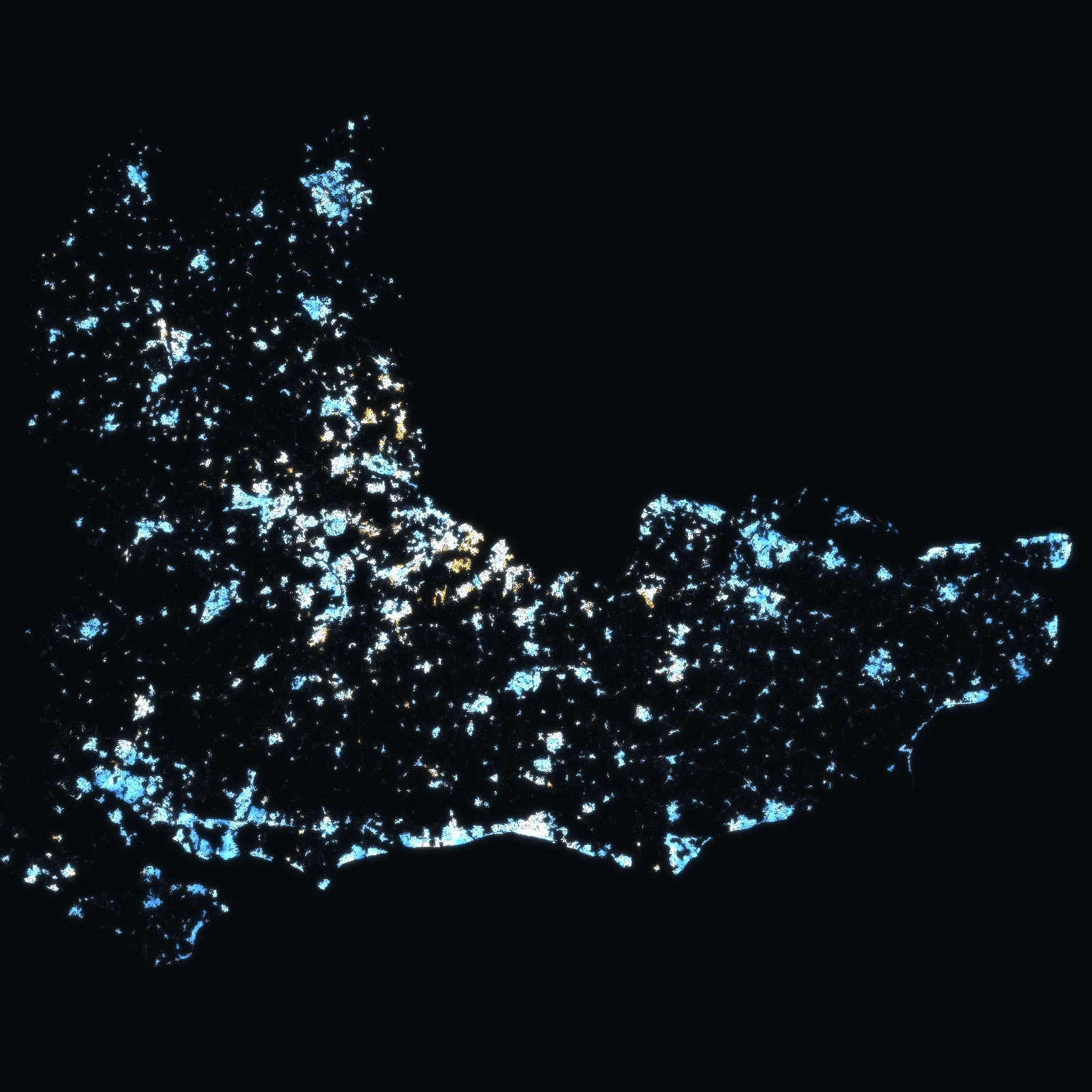
UK › South East · 64 local authorities · live
Every sale in the South East.
5,381,597 home sales in the South East's 64 local authorities since 1995 – 713,043 of them since October 2021, at 2,720,895 addresses – homes at a median of £382k (standard sales 2023–2025), with every one of its 4,021,474 freehold plots on the map, authority by authority.
Each authority opens on its own map. Sales as HM Land Registry publishes them, January 1995 – August 2026, with the prices by year since 1995; the latest months fill in as sales are registered.
HM Land Registry · ONS · Ordnance Survey · the VERA PI databases. No owner names. Counted from the files of 28 September 2026.
Authority by authority · South East
Pick an authority. Its map opens.
Every one of the South East's 64 local authorities – its freehold plots and its addresses on the map, the median price of the homes sold around them, flats and houses apart, and its prices by year since 1995. Each has its own address to share.
- Local authorityBuckinghamshire40,868 sales · 246,471 freehold plotsHomes £455k · flats £250k
- Local authorityMilton Keynes22,263 sales · 116,327 freehold plotsHomes £355k · flats £191k
- Local authorityBrighton and Hove20,849 sales · 79,041 freehold plotsHomes £413k · flats £312k
- Local authorityMedway20,498 sales · 119,737 freehold plotsHomes £308k · flats £190k
- Local authoritySouthampton16,394 sales · 64,779 freehold plotsHomes £255k · flats £163k
- Local authorityArun15,284 sales · 79,291 freehold plotsHomes £350k · flats £180k
- Local authorityMaidstone14,193 sales · 81,802 freehold plotsHomes £360k · flats £205k
- Local authorityWokingham13,984 sales · 79,340 freehold plotsHomes £490k · flats £265k
- Local authorityPortsmouth13,950 sales · 65,055 freehold plotsHomes £255k · flats £170k
- Local authorityWealden13,937 sales · 91,200 freehold plotsHomes £382k · flats £190k
- Local authorityMid Sussex13,596 sales · 71,486 freehold plotsHomes £440k · flats £245k
- Local authorityBasingstoke and Deane13,529 sales · 81,732 freehold plotsHomes £370k · flats £190k
- Local authorityNew Forest13,364 sales · 89,918 freehold plotsHomes £385k · flats £207k
- Local authorityCherwell13,207 sales · 82,349 freehold plotsHomes £358k · flats £175k
- Local authorityIsle of Wight12,699 sales · 72,341 freehold plotsHomes £260k · flats £146k
- Local authorityReading12,337 sales · 56,201 freehold plotsHomes £350k · flats £240k
- Local authoritySouth Oxfordshire12,275 sales · 76,275 freehold plotsHomes £450k · flats £250k
- Local authorityCanterbury12,252 sales · 74,617 freehold plotsHomes £350k · flats £205k
- Local authorityVale of White Horse12,251 sales · 68,327 freehold plotsHomes £400k · flats £217k
- Local authorityWest Berkshire12,167 sales · 79,002 freehold plotsHomes £400k · flats £210k
- Local authorityThanet12,126 sales · 61,075 freehold plotsHomes £295k · flats £175k
- Local authorityReigate and Banstead12,043 sales · 60,897 freehold plotsHomes £475k · flats £272k
- Local authoritySwale11,978 sales · 75,616 freehold plotsHomes £310k · flats £170k
- Local authorityHorsham11,747 sales · 70,436 freehold plotsHomes £438k · flats £225k
- Local authorityElmbridge11,309 sales · 57,386 freehold plotsHomes £660k · flats £365k
- Local authorityEastleigh11,216 sales · 59,970 freehold plotsHomes £340k · flats £185k
- Local authorityWindsor and Maidenhead11,213 sales · 64,386 freehold plotsHomes £525k · flats £320k
- Local authorityGuildford10,765 sales · 65,426 freehold plotsHomes £505k · flats £270k
- Local authorityWaverley10,589 sales · 62,825 freehold plotsHomes £555k · flats £281k
- Local authorityAshford10,472 sales · 70,378 freehold plotsHomes £350k · flats £185k
- Local authorityWinchester10,333 sales · 58,943 freehold plotsHomes £461k · flats £255k
- Local authorityChichester10,230 sales · 63,811 freehold plotsHomes £424k · flats £215k
- Local authorityTonbridge and Malling10,226 sales · 62,876 freehold plotsHomes £410k · flats £250k
- Local authorityDover10,086 sales · 59,944 freehold plotsHomes £300k · flats £175k
- Local authorityTunbridge Wells10,079 sales · 54,985 freehold plotsHomes £441k · flats £270k
- Local authorityFolkestone and Hythe9,913 sales · 54,685 freehold plotsHomes £312k · flats £201k
- Local authorityBracknell Forest9,899 sales · 56,400 freehold plotsHomes £410k · flats £249k
- Local authorityEast Hampshire9,898 sales · 62,433 freehold plotsHomes £425k · flats £215k
- Local authorityTest Valley9,772 sales · 60,574 freehold plotsHomes £360k · flats £190k
- Local authorityWorthing9,586 sales · 42,195 freehold plotsHomes £350k · flats £225k
- Local authorityWest Oxfordshire9,370 sales · 58,668 freehold plotsHomes £390k · flats £210k
- Local authorityDartford9,226 sales · 45,736 freehold plotsHomes £369k · flats £250k
- Local authorityFareham9,057 sales · 53,098 freehold plotsHomes £349k · flats £175k
- Local authorityHavant9,012 sales · 50,577 freehold plotsHomes £320k · flats £165k
- Local authorityEastbourne8,899 sales · 37,741 freehold plotsHomes £280k · flats £195k
- Local authorityRother8,643 sales · 53,007 freehold plotsHomes £360k · flats £195k
- Local authoritySevenoaks8,620 sales · 61,594 freehold plotsHomes £477k · flats £270k
- Local authorityLewes8,190 sales · 48,574 freehold plotsHomes £387k · flats £228k
- Local authorityHastings8,011 sales · 37,234 freehold plotsHomes £280k · flats £178k
- Local authorityHart7,947 sales · 44,251 freehold plotsHomes £465k · flats £240k
- Local authorityWoking7,823 sales · 42,567 freehold plotsHomes £450k · flats £265k
- Local authorityOxford7,351 sales · 43,266 freehold plotsHomes £455k · flats £316k
- Local authoritySpelthorne7,302 sales · 40,348 freehold plotsHomes £450k · flats £298k
- Local authorityRushmoor7,279 sales · 33,638 freehold plotsHomes £355k · flats £218k
- Local authorityRunnymede6,789 sales · 35,095 freehold plotsHomes £460k · flats £270k
- Local authoritySurrey Heath6,776 sales · 39,034 freehold plotsHomes £470k · flats £232k
- Local authoritySlough6,585 sales · 41,629 freehold plotsHomes £385k · flats £240k
- Local authorityCrawley6,583 sales · 38,119 freehold plotsHomes £345k · flats £220k
- Local authorityGravesham6,568 sales · 41,482 freehold plotsHomes £355k · flats £183k
- Local authorityTandridge6,486 sales · 45,086 freehold plotsHomes £500k · flats £290k
- Local authorityMole Valley6,443 sales · 44,262 freehold plotsHomes £585k · flats £282k
- Local authorityGosport6,107 sales · 30,128 freehold plotsHomes £250k · flats £155k
- Local authorityEpsom and Ewell5,545 sales · 29,481 freehold plotsHomes £535k · flats £335k
- Local authorityAdur4,781 sales · 26,327 freehold plotsHomes £375k · flats £238k
VERA PI · South East
Three tools, one region.
The same operating system as in France, New York, Florida and Massachusetts, with HM Land Registry underneath: the address, what sold there and around it since 1995, its postcode and its local authority.
Check a price · South East
Where does the asking price sit?
Pick an address, the kind of home and the asking price. VERA PI places the price among the standard sales of homes like it within 500 m – the median, the middle half, the share at or below it and how many sales stand behind them.
The method
Every published sale, at its address.
Every figure on these pages comes from the VERA PI databases: the sales HM Land Registry publishes, with their price, date, type, tenure and address; its own links between a sale and its UPRN; and the postcode directory and address points of the Office for National Statistics and Ordnance Survey – each with its version and date.
- HM Land Registry – Price Paid Data, the complete fileevery published residential sale in the South East since 1 January 1995: price, transfer date, type, tenure, new build, address and category – 5,381,597 in all, 713,043 of them since 16 October 2021
- Office for National Statistics – ONS Postcode Directoryeach postcode's current local authority and region (August 2026) – how a sale is placed in the South East and in its authority
- HM Land Registry – transaction to UPRN look-upits own links between a sale and its addressable location – new registrations from 2026, no backfill; a link that is not default-eligible, or a sale with two UPRNs, is never used
- Ordnance Survey – OS Open UPRN and Code-Point Openthe address points and the postcode centres (Code-Point Open 2026.3.0, OS Open UPRN September 2026)
- HM Land Registry – INSPIRE Index Polygonsthe indicative outline of every registered freehold title in the South East – 4,021,474 plots from the files of its local authorities; an address sits on a plot only when its linked UPRN point lies inside the outline
No owner names, ever, and no buyer or seller. Sales are shown as counts and as medians of ten or more, with their period and radius; a category B sale (repossessions, buy-to-let mortgages, sales to companies) and the type «other» are never in a median. A sale sits on the map at its officially linked UPRN point, or at its postcode’s centre – an area for many addresses, never the building. The plot outlines are indicative (HM Land Registry’s general boundaries rule) and freehold only – a leasehold flat has no outline of its own; an address sits on a plot only when its linked UPRN point lies inside the outline, never by its postcode centre. Not in the South East's file yet: energy certificates, VERA PI Estimate and Score, flood, planning, transport and neighbourhood context, lease length – each is shown as missing, never as a proxy. There is no price per m². The latest months are incomplete: a sale reaches the data weeks or months after it completes.
Contains HM Land Registry data © Crown copyright and database right 2026, licensed under the Open Government Licence v3.0. The polygons (including the associated geometry, namely x, y co-ordinates) are subject to Crown copyright and database rights 2026 Ordnance Survey AC0000851063. Source: Office for National Statistics licensed under the Open Government Licence v.3.0. Contains OS data © Crown copyright and database right 2026. Contains Royal Mail data © Royal Mail copyright and database right 2026. Contains National Statistics data © Crown copyright and database right 2026. Contains GeoPlace data © Local Government Information House Limited copyright and database right 2026. Map: © OpenStreetMap contributors, OpenFreeMap.